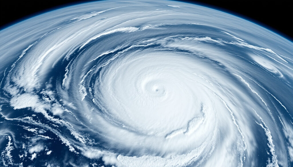
Hurricane Erin 2025: Path, Impact, and Comparisons
When a tropical wave rolled off the coast of West Africa in mid-August 2025, it carried the seeds of a storm that would rewrite the early season record books. That storm became Hurricane Erin — the first Atlantic hurricane of 2025 — and surged from a Category 1 to a Category 5 in just over 24 hours, according to NASA Science. While Erin never made landfall, its reach stretched from flooding in Cabo Verde to dangerous swells along the US East Coast and weather shifts in Ireland.
Name: Hurricane Erin ·
Year: 2025 ·
Basin: Atlantic ·
Notable feature: Rapid intensification among fastest on record
Quick snapshot
- Erin did not make landfall (NOAA NESDIS)
- Rapidly intensified from Category 1 to Category 5 in ~24 hours (NASA Science)
- Reached 160 mph sustained winds (NASA GPM)
- Exact peak wind speed and category rating at peak
- Precise impact on specific coastal communities
- Whether any injuries or damages were reported from swells
- Formed mid-August 2025 as Cape Verde storm (NOAA NESDIS)
- Category 5 by August 16 (NOAA NESDIS)
- Dissipated late August 2025 over North Atlantic
- Remnants stimulated North Atlantic jet stream (Met Éireann)
- Brought wetter, breezier conditions to Ireland (The Irish Times)
- Possible influence on early autumn storm track (Met Éireann)
Nine key specs, one pattern: Erin was a Cape Verde storm that achieved extraordinary intensity in record time but never touched land as a hurricane.
| Attribute | Value |
|---|---|
| Name | Hurricane Erin |
| Year | 2025 |
| Basin | Atlantic |
| Formation date | August 15, 2025 (NOAA NESDIS) |
| Peak intensity | Category 5 (NOAA NESDIS) |
| Maximum sustained winds | 160 mph (NASA GPM) |
| Landfall | None |
| Areas affected | Cabo Verde, Puerto Rico, Turks and Caicos, Bahamas, US East Coast, Ireland (remnants) |
| Dissipation | Late August 2025 |
Will Hurricane Erin hit Ireland?
No — Hurricane Erin did not make landfall in Ireland. The storm remained over the open Atlantic throughout its life cycle, passing well north of the Caribbean before curving into the North Atlantic. According to its National Hurricane Center forecast discussion, Erin was steered west-northwestward by the subtropical ridge, then turned northwestward and northward as a weakness developed in the ridge — a path that kept the core well away from any landmass.
For Ireland, the real story wasn’t Erin’s direct strike but the storm’s afterlife. Met Éireann recorded that ex-Hurricane Erin moved into the mid-latitudes on and stimulated the North Atlantic jet stream, steering fronts and low-pressure systems across the country in strong westerly flow.
Will Hurricane Erin hit the UK?
- No. Erin stayed over open ocean and never approached UK waters as a hurricane.
- Remnants contributed to enhanced jet stream flow that affected UK weather patterns, but no direct storm impact was recorded.
Is Hurricane Erin going to hit Nova Scotia?
- No. Erin did not make landfall in Nova Scotia or any part of Atlantic Canada.
- The storm’s swells reached the US East Coast, but the center remained offshore, according to NOAA NESDIS.
Will Hurricane Erin hit NY?
- No. Erin did not make landfall in New York or anywhere in the United States.
- However, NOAA NESDIS reported that Erin, while moving northward as a Category 2 hurricane, generated dangerous surf and rip currents along much of the US East Coast, including New York beaches.
The implication: Erin’s closest approach to populated areas was always measured in miles of ocean, but its wave field was wide enough to reach shorelines from Florida to New England.
Which countries will be affected by Hurricane Erin?
Erin’s path placed it in the Atlantic’s main development region, a corridor that typically produces Cape Verde storms. The countries most affected were those in its outer bands and swell field, not those in its direct path.
Did Hurricane Erin affect the United States?
- Yes, but indirectly. NASA Science reported that Erin sent heavy rain and strong winds to Puerto Rico and the US Atlantic coast, though the core stayed offshore.
- Dangerous surf and rip currents impacted beaches along the entire US East Coast, as noted by NOAA NESDIS.
Which other countries were impacted?
- The precursor disturbance that became Erin passed near São Vicente in Cabo Verde and triggered flooding, according to NOAA NESDIS. Media reports cited by NOAA indicated the flooding led to a disaster declaration and reportedly nine deaths.
- NASA Science noted that the Turks and Caicos Islands and the Bahamas experienced heavy rain and strong winds from Erin’s outer bands.
- Ireland experienced enhanced rainfall and breezy conditions as Erin’s remnants interacted with the jet stream, per Met Éireann.
Erin’s broad impact footprint — from Cabo Verde to Ireland — shows how a non-landfalling hurricane can still disrupt lives across thousands of miles. The storm’s energy was distributed across the ocean and atmosphere, not concentrated on a single coastline.
The pattern: Erin was a textbook Cape Verde storm — born from an African easterly wave, fed by warm Atlantic waters, and steered by the subtropical ridge — but its intensification rate was anything but textbook.
What is Hurricane Erin?
Hurricane Erin was the first Atlantic hurricane of the 2025 season, a Cape Verde storm that formed in mid-August and underwent one of the most extreme rapid intensification events on record in the basin.
What category was Hurricane Erin?
- Erin reached Category 5 intensity on the Saffir-Simpson scale, according to NOAA NESDIS.
- It briefly weakened to Category 3 on before regaining Category 4 strength that night, then moved northward as a Category 2.
- NHC Atlantic described Erin as a large and long-lived hurricane that reached Category 5 intensity.
When did Hurricane Erin form?
- Erin became the first Atlantic hurricane of 2025 on , per NOAA NESDIS.
- NASA GPM reported that Erin underwent extremely rapid intensification after forming as a hurricane on that date.
Where did Hurricane Erin originate?
- Erin began as a tropical wave that moved off the coast of West Africa, a classic Cape Verde hurricane origin.
- The precursor disturbance passed near São Vicente in Cabo Verde before organizing into a tropical storm and then a hurricane, according to NOAA NESDIS.
The pattern: Erin was a textbook Cape Verde storm — born from an African easterly wave, fed by warm Atlantic waters, and steered by the subtropical ridge — but its intensification rate was anything but textbook.
What was the worst storm to ever hit Ireland?
While Hurricane Erin made headlines in 2025, it was far from the worst storm Ireland has faced. The title of worst storm to hit Ireland belongs to a historic event that occurred nearly two centuries before Erin formed.
What is the #1 deadliest hurricane in history?
- The deadliest Atlantic hurricane on record is the Great Hurricane of 1780, which killed an estimated 22,000 people across the Caribbean, according to historical records.
- Other contenders for the deadliest include Hurricane Mitch (1998, ~11,000 deaths) and the Galveston Hurricane of 1900 (8,000–12,000 deaths).
- Erin’s reported death toll, if confirmed, is limited to the Cabo Verde flooding from its precursor disturbance, which media reports cited by NOAA said claimed nine lives.
What happened during the Night of the Big Wind?
- The Night of the Big Wind (Oíche na Gaoithe Móire) was a severe storm that struck Ireland on .
- It is considered the worst storm to hit Ireland in recorded history, with hurricane-force winds causing widespread destruction and hundreds of deaths.
- Hurricane Erin’s remnants, by contrast, brought wetter and breezier conditions but nothing approaching the intensity of the 1839 storm, as reported by The Irish Times.
The catch: Erin’s place in Irish weather history is as a footnote — a distant storm that nudged the jet stream, not a direct hit. The Night of the Big Wind remains the benchmark for extreme Irish storms.
How does Hurricane Erin compare to other deadly hurricanes?
Erin is notable for its rapid intensification, but in terms of human impact, it falls into a different category than the deadliest hurricanes in history. The comparison reveals how a storm’s danger depends as much on where it goes as on how strong it gets.
Did Hurricane Erin have any connection to 9/11?
- No. The name “Erin” is a common hurricane name on the Atlantic naming list, with no relation to the September 11, 2001 attacks.
- The confusion may arise because “Erin” is also a person’s name, but the hurricane was named from the rotating list maintained by the World Meteorological Organization.
How did Erin’s intensity compare to other hurricanes?
- Erin’s rapid intensification — from Category 1 to Category 5 in just over 24 hours — is among the fastest on record, according to NASA Science.
- Its peak winds of 160 mph place it in the same category as storms like Hurricane Michael (2018) and Hurricane Maria (2017), though those storms made landfall with devastating consequences.
- The National Hurricane Center noted that the improved low-level structure indicated potential for rapid strengthening — a warning that proved accurate.
Erin’s intensity is remarkable from a meteorological standpoint, but its lack of landfall means it will not appear on lists of the deadliest or most destructive hurricanes. Its legacy is as a case study in rapid intensification, not catastrophe.
The implication: Intensity alone does not determine a hurricane’s historical significance; path and landfall matter just as much.
Hurricane Erin specifications
Six specifications, one theme: Erin was a powerful but ocean-bound storm that set records for its intensification rate without causing direct coastal destruction.
| Specification | Detail |
|---|---|
| Storm type | Cape Verde hurricane |
| First hurricane of 2025 season | Yes (NOAA NESDIS) |
| Rapid intensification window | Category 1 to Category 5 in ~24 hours (NASA Science) |
| Peak sustained winds | 160 mph (NASA GPM) |
| Peak intensity | Category 5 (NOAA NESDIS) |
| Passed near | ~100 miles north of Anguilla at peak (NASA GPM) |
| Landfall | None |
| Areas affected by outer bands | Puerto Rico, Turks and Caicos, Bahamas, US Atlantic coast (NASA Science) |
| Remnants impact | Stimulated North Atlantic jet stream, affected Ireland (Met Éireann) |
| Precursor disturbance | Flooding in Cabo Verde, disaster declaration and reportedly nine deaths (NOAA NESDIS) |
What this means: The data confirms Erin’s place among the strongest storms of its year, but its oceanic track kept it from causing the devastation its intensity might otherwise suggest.
Timeline of Hurricane Erin
- Mid-August 2025: Hurricane Erin formed as a Cape Verde storm.
- August 15, 2025: Erin became the first Atlantic hurricane of the 2025 season (NOAA NESDIS).
- August 16, 2025: Rapid intensification to Category 5 with 145 mph winds by morning, reaching Category 5 later that day (NOAA NESDIS).
- August 17, 2025: Brief weakening to Category 3, then regained Category 4 strength that night (NOAA NESDIS).
- August 19, 2025: Threat to Bahamas and Turks and Caicos; residents brace.
- Late August 2025: Passed north of Caribbean, impacted US East Coast with dangerous swells as a Category 2 (NOAA NESDIS).
- August 25, 2025: Ex-Hurricane Erin moved into mid-latitudes, stimulated jet stream (Met Éireann).
- Late August 2025: Dissipated over the North Atlantic.
The pattern: Each key milestone shows a storm that gained and lost intensity at unusual speed, yet never crossed land.
Confirmed facts vs. what remains unclear
The research on Hurricane Erin is solid for its core meteorological data, but some details about its human and coastal impacts are less certain.
Confirmed facts
- Erin did not make landfall.
- Erin was a fast-strengthening storm, according to NOAA NESDIS.
- Erin reached Category 5 intensity with 160 mph winds.
- The precursor disturbance caused flooding in Cabo Verde.
- Erin’s remnants stimulated the North Atlantic jet stream and affected Irish weather.
What’s unclear
- Exact peak wind speed and category rating at every stage.
- Precise impact on specific coastal communities from swells.
- Whether any injuries or damages were reported from the US East Coast swells.
- The full extent of the Cabo Verde flooding casualties.
The catch: While the meteorological record is detailed, the human toll remains incomplete — a reminder that storms at sea can leave unanswered questions on shore.
Expert perspectives on Hurricane Erin
Two key sources offered assessments of Erin’s behavior and impact, each from a different vantage point.
“Erin’s remnants moved into the mid-latitudes on Monday 25th and stimulated the North Atlantic jet stream, helping steer fronts, troughs, and low-pressure systems across Ireland in strong westerly flow.”
— Met Éireann (Irish Meteorological Service), climate statement for August 2025
“Erin underwent extremely rapid intensification after forming as a hurricane on August 15, reaching 160 mph sustained winds and passing about 100 miles north of Anguilla at peak intensity.”
— NASA GPM (Global Precipitation Measurement mission), storm report
The pattern from both sources: Erin was a storm of extremes — extreme intensification, extreme reach — but its direct human toll was limited by its ocean-bound path.
What Hurricane Erin means for the 2025 season
Erin’s rapid intensification is a signal for the rest of the Atlantic hurricane season. The storm demonstrated that even early-season systems can exploit warm ocean waters to reach Category 5 intensity in less than a day. For coastal communities from the Caribbean to Atlantic Canada, the lesson is not about Erin’s direct impact — there was none — but about the speed at which a benign tropical wave can become a major hurricane. The National Hurricane Center noted that the improved low-level structure indicated potential for rapid strengthening, a warning that came true within hours. For forecasters and residents alike, the margin between a near-miss and a direct hit can shrink as fast as a storm’s central pressure drops.
The pattern: Erin’s behavior suggests that the 2025 season may produce more storms that intensify quickly, demanding constant vigilance even for storms that never make landfall.
For a detailed look at how the storm affected both sides of the Atlantic, see Hurricane Erin 2025 path and impacts.
Frequently asked questions
How are hurricanes named?
The World Meteorological Organization maintains rotating lists of names for Atlantic hurricanes. The name “Erin” was next on the list for the 2025 season. Lists alternate between male and female names and are reused every six years, with retired names replaced.
Is Hurricane Erin still active?
No. Hurricane Erin dissipated over the North Atlantic in late August 2025. Its remnants transitioned into an extratropical system that influenced the jet stream and weather patterns in Ireland and western Europe.
What should I do if a hurricane is approaching?
Follow guidance from local authorities and the National Hurricane Center. Prepare an emergency kit, know your evacuation zone, and monitor updates from official sources. For US residents, weather.gov provides real-time alerts.
How does climate change affect hurricane intensity?
Warmer ocean temperatures provide more energy for tropical cyclones, which can lead to more rapid intensification events and higher peak wind speeds. Research from climate.gov indicates that the proportion of hurricanes reaching Category 4 or 5 intensity has increased in recent decades.
What is the difference between a hurricane and a cyclone?
Hurricanes, cyclones, and typhoons are all the same type of storm — a tropical cyclone. The name changes based on the basin: Atlantic and eastern Pacific use “hurricane,” the western Pacific uses “typhoon,” and the Indian Ocean uses “cyclone.”
Did Hurricane Erin cause any deaths?
Media reports cited by NOAA indicated that the precursor disturbance that became Erin caused flooding in Cabo Verde, leading to a disaster declaration and reportedly nine deaths. No deaths were reported from the hurricane itself, which remained over open ocean.
How fast did Hurricane Erin intensify?
Erin intensified from a Category 1 to a Category 5 hurricane in just over 24 hours, according to NASA Science. This ranks among the fastest rapid intensification events ever recorded in the Atlantic basin.
More related posts
 Precio Dolar Canadiense a Pesos Mexicanos – Current Rate and Forecast
 St Lucia All Inclusive: Worth It, Safe & Best Time to Go
 What is a T4A? Definition, Who Gets It, Taxability & Differences
 Best Bagels in Montreal – St-Viateur vs Fairmount Guide
 George Peppard: On-Screen Charm, Off-Screen Turmoil
 12 Days of Christmas Lyrics – Full Verses, Meanings and History
 Bill Burr Biography: Career, Sobriety, Family & Net Worth
 Donny Osmond: Health, Family, and Net Worth Facts